Origins
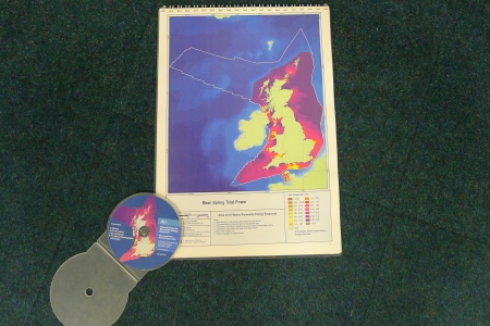
The Atlas of UK Marine Renewables Energy Resources was first published in September 2004, under funding from the Department of Trade and Industry’s (DTI) Strategic Environmental Assessment (SEA) programme for Offshore Energy.
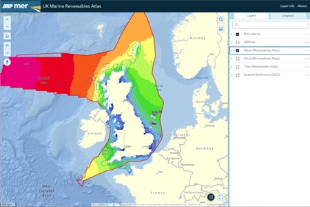
It was updated in 2007 to ensure the most reliable data sources were recognised in the definition of primary resource parameters for waves, winds and tides and to enable greater access to datasets through a free to use online web-GIS service.
Additional data
ABPmer retains an in-house development programme to extend the information made available through the Atlas, and actively monitors uptake across the industry.
Since launch, we have developed a set of unique exploration tools to complement the resource maps, to enable a greater level of understanding at site selection, and added additional data such as tidal ellipses.
In 2024, to mark its 20th anniversary, the Atlas underwent a major update, to include:
Additional data and layers
- The Crown Estate and Crown Estate Scotland lease areas for wind, wave and tide
- Offshore 1:250 000 scale Seabed sediments and bedrock WMS layers from British Geological Survey (BGS)
- Marine Plan Areas for England (Marine Management Organisation)
- Wind and wave summary statistics, and wind and wave rose plots from ABPmer’s SEASTATES metocean database
Improved usability
- Simplified layout and navigation
- Improved responsiveness across multiple devices, ensuring a seamless experience across desktop, tablet and mobile
- Inclusion of data layer search function
- Ability to interrogate multiple data layers simultaneously
The Atlas continues to attract great interest across the industry and remains the most recognised source of freely available information of detailed regional descriptions of potential marine energy resources in UK waters.